Active Thanksgiving Week for Much of The U.S.
*Since it is a holiday week, this post will be entirely forecast-based*
It will be a pretty active week weather-wise across the country, with different regions expected to see rain, snow, and severe weather.
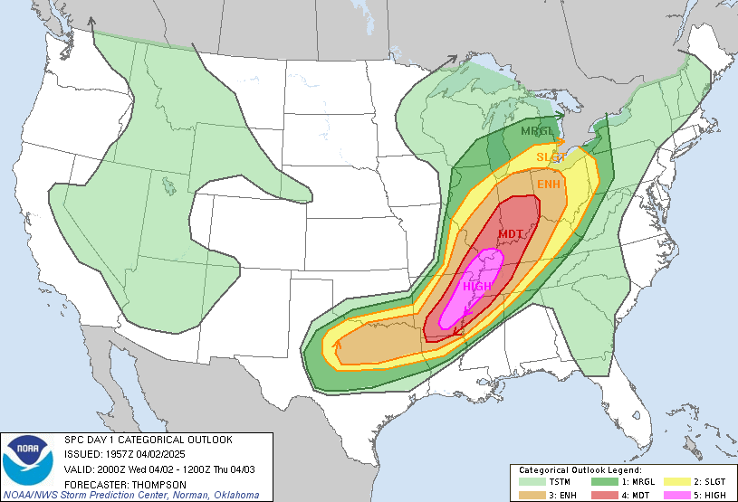
First, though, let's talk about the rain and the severe weather. Many areas in the South have the possibility of seeing severe weather for the first half of the week. On Monday, the severe threat will mainly be in the Deep South, specifically in parts of Eastern Texas, Louisiana, Arkansas, Mississippi, and Alabama. In these areas, there will be a threat of tornadoes, damaging hail, and damaging winds, with the highest threat for these being in Mississippi and Louisiana.
 |
| Storm Prediction Center (SPC) convective outlook for Monday, November 20 (image by NOAA/NWS) |
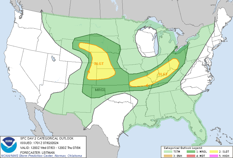
On Tuesday, the same severe weather will shift eastward into Alabama and Georgia, where the same threats will exist at a lower risk. The areas that will most likely see the highest threat on this day are those in Southern Alabama and parts of the Florida Panhandle. There will also be a slight risk for severe weather in parts of the Carolinas by Tuesday evening/night.
 |
| SPC convective outlook for Tuesday, November 21 (image by NOAA/NWS) |
Now shifting gears to snow. A lot of the Northern U.S. is expected to see some snow this Thanksgiving week courtesy of a large and powerful storm system. Many in the Central and Northern Rockies will see snow on Thanksgiving day and on Friday, where most areas are expected to pick up around 3-6 inches of snow.
Moving east to the Midwest, snowfall is expected mainly on Tuesday in the Great Lakes Region, where some ice could also form due to the rather modest temperatures that will be in place during most of this time.
Last but not least, parts of the Northeast will see snow on Tuesday night into Wednesday as the same storm system moves eastward. The snow will mainly be located in the New England region, especially in higher elevations, where 3-6 inches of snow is expected. There once again is a threat for ice, particularly in Appalachia. As the storm system finally moves offshore into the Atlantic, it will leave very gusty winds behind on Thanksgiving for those same areas, with gusts as high as 40 mph.
I hope everyone has a great and safe Thanksgiving week!

Comments
Post a Comment